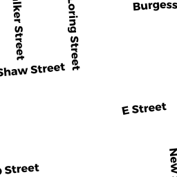
67 S LORING ST
Owner Information
ROGERS PHILIP A
67 S LORING ST
LOWELL, MA 01851 3715


Property Details
67 S LORING ST is classified as a Single Family Residential (Conventional).
The primary structure on this property was built in 1896. There are 3,329ft2 of built area within this property. There is 2,008ft2 of residential/living space within this property. This property is listed as having 7 rooms.
67 S LORING ST is valued at $320,400. The land is valued at $93,700 and the structures are valued at $225,700. There is an additional valuation of $1,000 on this property.
This property is in Zone TSF. Confirm with local Zoning Board authorities to ensure there are no overlays or other easements on this property.
The most recent deed for 67 S LORING ST is recorded at the local registrar in Book 5031, Page 0023. 67 S LORING ST was last sold on Thursday, October 5, 1989 for $90,000.
Assessment data from fiscal year 2021.
Flood Data
According to the FEMA National Flood Hazard Layer, this property does not appear to be in a flood zone. It may also be in an area not yet reviewed. Nonetheless, confirm this information prior to taking any action.
To view the flood hazards around this property, create a FEMA "Firmette" Map of the area around 67 S LORING ST.
Broadband Internet Providers
| Provider | Type | Bandwidth (mbps) | |
|---|---|---|---|
| VSAT Systems, LLC. | Satellite | 2 | 1 |
| HughesNet | Satellite | 25 | 3 |
| GCI Communication Corp. | Satellite | 0 | 0 |
| T-Mobile | Fixed Wireless | 25 | 3 |
| Comcast | Cable | 1000 | 35 |
| Verizon New England Inc. | DSL | 10 | 1 |
| Viasat Inc | Satellite | 100 | 3 |
Broadband service provider data from December 2020.
Adjacent Properties
- 72 S WALKER ST
Single Family Residential owned by PICH REY - 78 S WALKER ST
Single Family Residential owned by PENG THAVERY - 73 S LORING ST
Single Family Residential owned by TRS LOUH FAMILY TRUST - 63 S LORING ST
Single Family Residential owned by PRAK RAKSMEY - 68 S WALKER ST
Single Family Residential owned by CHEA ALEXIS SOPHANY